Saturday, May 22, 2010

What makes a wake like that? April 18, 2010

As we were leaving Sanispac for another long day of sailing up to Santa Rosalia - the northern most point on our trip -we were coming around the headlands near Santo Domingo when Phil got concerned that we were going to run into a reef.  We could see all this white water in the not too far off distance and when you see white water, water has to be breaking over something. 

Phil ran below to get his binoculars and then he turned to me and said it's not a reef.  It's a pod of over 1,000 dolphins feeding.  Here are some pictures of what that looks like.


What is that out there?

The wall is getting closer

Here they come!

I can see some of them

Feeding frenzy - birds and dolphins

Playing in the water

There are even more coming
Along side the boat

Playing the the wake of the boat
The orange is Ryan's shirt as we stood on the bow of the boat to take pictures

Gliding along side
We captured one all by itself

Dolphins coming along side

Dolphin fun


This was to be the first of about 4 such pods that we ran into over the course of the next week between Bahia de Conception and Santa Rosalia.  The best display of acrobatics we saw was when we entered Punta Chivato - about a week away - stay tuned for more on that one. We discovered that there were several varieties of dolphins in the different pods we came across.  Kelly would sit with the mammals book for hours trying to figure out just which type of dolphins we had run across.  She got pretty good at identifying the species by the middle of May.

Stay tune for more on our adventures.

Sanispac in Bahia de Conception, April 17-18, 2010

From San Juanico, we wanted to head north about 45 miles to Bahia Santo Domingo (26 51.96'N, 111 50.85W), just inside the entrance to Bahia Conception. We normally motorsail around 5.5 knots to stretch our fuel, but around Punta Pulpito noticed that our speed over the ground (thank you, GPS, for giving us too much information to play with!) had fallen to less than 4 knots. What the heck??? Oh yeah, we're on the ocean and it sometimes has contrary currents!! That slowed us down for a couple hours, but we continued up the coast and eventually rounded the corner into Bahia Conception, a 100-square mile bay with loads of anchorages and beaches. Since it is the Baja, however, those beautiful, dramatic islands and volcanic peaks you see often extend well off-shore underwater. In the middle of the bay you end up in water that is only 24 feet deep.

Baja's major highway, Route 1, runs down the western side of the bay, so there are loads of RV sites, vacation homes, and campsites along the shore. I know it's hard to believe, but it's getting late in the season here and most of the sites were empty. As a result, it's very quiet here except for those 18-wheelers that have to come down this steep hill with their breaks screeching the whole way and then when they hit the bottom of the grade they have to accelerate to climb back up on the other side of the mountain. All night long you not only hear the waves lapping against the boat but the piercing wail of those breaks.

The wind and swell continued strong right into the Santo Domingo anchorage, so we made the decision to continue further into the bay in search of a more sheltered spot. That's not a decision to be taken lightly, since it's another 8 miles into the bay to the next anchorage. But, even after 45 miles, with that much wind blowing, it was a no-brainer. After a nice sail down the bay (yeah, Phil made us shut off the engine for a while just to remind him how beautiful water sounds rushing over a hull), we ended up in Playa Santispac (26 45.78' N, 111 53.17 W) with a bunch of other boats that were also trying to hide from the wind. So after 9 hours and over 50 nautical miles we finally had arrived. Kelly and dad inflated the dinghy so we could go ashore.

Kelly bouncing on the pump to inflate the dink

There's a restaurant at Santispac called Ana's, and we felt like a break from the galley, so we dinghyed ashore to check it out. Well, the place was hopping! Apparently, we arrived on one of the big nights in town. As we ate dinner, more and more people (aka RVers) kept arriving until every table and bar stool was filled. There were probably 80 people in the place. There were two or three groups just waiting for us to finish so they could take our table. They figured it was a safe bet that with kids we weren't going to be staying till the bitter end. The place jumps until 10 PM when it shuts down cold.

Phil and the kids in front of Anna's (and the Pacifico sign)

Walking into the popular restaurant - we were about the only one's that came by boat - see all the SUVs!

We have another long leg to Santa Rosalia in the morning, so we hit the sack early, dreaming of those "exquisitos". More later.

What was behind us as we were leaving Sanispac

The islands that dot the coast in Bahia de Conception

Thursday, May 20, 2010

Caleta San Juanico, April 14-17, 2010

We had a gorgeous sail from Puerto Ballandro to Caleta San Juanico. Several folks we've met have told us this is their all-time favorite place in the Baja, and now we know why!

Since we had winds from the north, we chose the northern anchorage between the rocks known as "The Spires."

The "Spires" - from the crazy camera that makes everything blue

One of the rock formations in the anchorage where you can snorkel
There were about 10 other boats in the area, so anchoring is always fun. We found a spot a few hundred yards off the beach and were only in 15 feet of water. You have to balance your desire to get "tucked in" to the best spots with the need to not get on top of your neighbor. The "Golden Rule" we all learned in kindergarten still applies: Don't anchor any closer to your neighbor than you would like them to anchor next to you! Still, there's plenty of room, even if you have to move out a few yards. The worst you'll have is a bit of swell from the Sea of Cortez to deal with. With your basic "land and sea breezes" predicted for the days we would be here, all we'd have were some 10-15 knot, on-shore breezes in the afternoon that die off as the sun goes down. We could deal with that.

The north side of the anchorage where you can also snorkel

 
Our first trip to shore was to walk around and see the "Cruiser's Shrine" that's tucked up into the corner of the northeastern beach. It's more informal than the name implies, but it's still fun to see all the signs, markers, and art projects from prior cruisers. Some folks put their boat names on wooden boards, others carve them into rocks, others make flags, etc. Then they hang them all over the one tree on the end of the beach. Some of the markers are quite the elaborate art project, while others are simply messages tucked into wine bottles. Some of the markers note visits for 5 or 6 years in a row! Kelly and Ryan grabbed a Magic Marker and immediately wrote our names on a flat rock, but who knows how long that will last before the sun fades it into obscurity. I wanted something more permanent and gathered shells to make a mobile. Our boat's name is now spelled out in shells that hang down from a branch on the tree. Hint, hint: There's plenty of room for you to come down and add your name!
The gang in front of the shrine

The first item we left at the shrine

Our second addition to the shrine

One of the cruisers was celebrating a birthday while we were here, so we had a pot luck dinner on the beach in his honor. The cruiser community is amazing: On a few hours notice for the party (literally, one of the cruisers went around in her dinghy announcing the event to each boat at 1 PM, for a party at 4 PM), we ended up with a chocolate mole chicken salad, a couple of curry dishes, pasta and rice salads, cabbage dishes, salamis, cheeses, an award-winning salsa with jalapeno AND serrano chilies (muy caliente, but muy bueno!!), chocolate brownies and a hot peach cobbler! Wow! The variety and creativity was amazing! One of the cruisers even brought her fiddle to play "Happy Birthday," as well as that other birthday classic, "Turkey in the Straw."

Sabbatical brought a bocce ball set and that was as popular as ever. But we were most intrigued by a new game we tried called Coob(?) (Who knows how to spell it,we wouldn't know an umlaut if it bit us in the butt!). It's supposedly a Viking game of some sort, with each team tossing foot-long, 2-inch diameter dowels at opposing blocks of 3" x 3" wood about 10 yards apart. No, you don't have to wear horned helmets to play the game, but for such a "casual" beach game, suffice to say that folks' competitive natures came out just a wee bit. We may have to make a set to add to the boat's equipment list.

Of course, one of the great benefits of the pot luck is the chance to meet your fellow cruisers. It turns out that one of our neighbors Claudia from Pelican is a no-kidding geologist and told us about the obsidian rocks that were right above our heads in the cliffs. They're called "Apache Tears" by amateur rock hounds, and they were fun to find and dig out of the hillside. They range in size from a pea to a golf ball.

Kelly rock hounding for "Apache tears"

Mom pointing out one of the obsidian rocks  aka "Apache tears"

Ryan has found one too!

Terrie, another cruiser from the S/V Circe taught Kelly about a dozen tricks with string (aka cat's cradle).

We also met one of the semi-locals, Frank,a guy from Taos, New Mexico, that comes down here each winter to ride his mountain bike over the dirt roads. He simply parks his camper on the beach and settles in for the season. He's a great guy and gets invited to all the pot lucks. In fact, he was the one that brought the award-winning salsa dish. Man, we need to get that recipe! Frank was fun but his dog “Babe” was a hoot. She would dig up crabs on the beach and throw them in the air. She was more fun to watch then the local pelicans.
Our days here have passed too quickly and we want to come back on our way south. We haven't even had a chance to explore all the other beaches in this beautiful bay or look for quartz in the southern hills. San Jaunico has turned into one of our absolute favorite places in all of Mexico!

Our next stop: The entrance to Bahia de Conception for a night, then on to Santa Rosalia. We met some friends from Old Moon that were coming back south and they raved about the "exquisitos," the legendary, bacon-wrapped hot dogs with all the trimmings in Rosalia. Hmmm, we may need to try a few of those and see how they compare to the infamous "Cubi Dogs," another legendary hot dog, but this one from the Cubi Point Officer's Club in the Philippines that the Cap'n used to love in his mis-spent youth in the Marine Corps. And, since it was a French mining town for so many years, Santa Rosalia should provide our first real baguettes since the legendary French Baker in Barra de Navidad, some 600 miles ago. Maybe they'll have croissants too? Oh, dare we hope?


The kids playing on the beach in front of Frank's camp

Ryan posing at the base of the hill where we did our rock hounding

Puerto Ballandra on Isla Carmen, aka/ the Death March, April 12-14, 2010

It's a quick sail from Puerto Escondido to Puerto Ballandra on Isla Carmen - less than 20 miles. Some cruisers try for Honeymoon Cove on Isla Danzante since it's only 4 miles from Escondido, but it's fairly small and won't hold more than a few boats. Several boats were already there, so we figured we'd stop at Honeymoon Cove on the way back south. Islas Danzante, Carmen, Coronados, Monserrate and Catalina make up a National Park and are patrolled by rangers.

It was another warm, clear, perfect day in the Baja. The nights are still surprisingly cool, but that will probably end in the next few weeks as summer approaches. By then, the water should start to warm up as well. Water temps over the past few weeks have been fairly steady at 70 degrees according to "Fred", our yellow duck pool thermometer that we tie off the back of the boat. Time to break out the wet suits! Yeah, we know that's as good as it gets at Catalina Island by late summer, but we sure miss the 85 degree water we had over 500 miles south of here. It's hard to believe how far we've sailed since we got down here!!

Puerto Ballandra is a nice-sized bay, maybe a half-mile across, but a submarine canyon runs down the middle of it, forcing boats to anchor along the edges. Most of the bay is sand, but some of the bottom is covered with loose rock with poor holding, so be sure to check the set of your anchor. Once the hook is set, though, it's a pretty anchorage, with plenty of rugged hills and cactus. There are even a few, hardy trees near the brackish ponds and along the arroyo where flash floods seem to be the only source of water for the plants up there. There are plenty of birds, including more than a few seagulls that come looking for handouts.

Sabbatical at anchor in the northwest corner of Puerto Ballandra

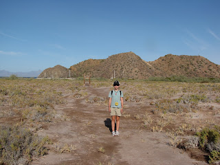
Kelly at the trailhead with the anchorage in the background

The hike begins

Some of the kinds of things we saw on the hike

Kelly and Ryan in the dried up arroyo

Are we there yet?

We made it to the ridge line and could see Salinas on the other side of the island

Kelly and Ryan with the salt pits in the far off distance

The town we hope to visit on the way back was just too far to hike to

The gang on the ridge line overlooking Salinas

Looking back on where we had come from

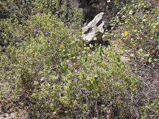
For lawnboy - purple wild flowers blooming on ballandra

Heart-shaped bush we found on the island

The "bee" tree had hundreds of bees in it

The little paper lanterns that Phil really liked

The paper lanterns up close

Ryan climbing the rocks on the way back

Yeah, we made it back!
Carmen, as part of the Loreto national park system has some great hiking up the arroyo on the eastern edge of the bay. You can hike from the anchorage all the way to the other side of the island to the abandoned salt-making town of Las Salinas, but it will take you all day to get there and back. It took us two hours to hike up the arroyo to the ridge line where we could finally see the town, but it would have been at least another hour to get down there. Add a couple of hours to explore the ghost town, plus the return trip, and let's just say our smaller crew members would not have been very happy. Nor would the larger crew members that would have had to carry the smaller ones back. (We actually ended up anchoring on the other side of the island on the way back so we could visit the ghost town.) Still, the hiking was fun and was our longest march since we've been in Mexico. There were plenty of cacti, thorn bushes, interesting vegetation and a surprising number of blue, white and yellow wild flowers. (We’ve included some pictures for the benefit of our friend lawnboy who told us we would find nothing green in the Sea of Cortez.) The Phil’s favorite was a bush with seed pods that looked like miniature Chinese paper lanterns. How something so delicate survives in such a harsh environment is beyond me. We saw plenty of signs of goats and rabbits ("Yes, Ryan, those are rabbit pellets again."), walked next to loads of bees in search of fresh water and, in general, had a grand time. I wonder why everyone went to bed early that night?
We spent only two nights in Ballandra since we wanted to keep moving north. The next leg will be 25 miles to Puerto Juanico, a spot that several cruisers have told us is their favorite spot in all the Baja. We'll see...

Wish you were here to enjoy this!