It was another warm, clear, perfect day in the Baja. The nights are still surprisingly cool, but that will probably end in the next few weeks as summer approaches. By then, the water should start to warm up as well. Water temps over the past few weeks have been fairly steady at 70 degrees according to "Fred", our yellow duck pool thermometer that we tie off the back of the boat. Time to break out the wet suits! Yeah, we know that's as good as it gets at Catalina Island by late summer, but we sure miss the 85 degree water we had over 500 miles south of here. It's hard to believe how far we've sailed since we got down here!!
Puerto Ballandra is a nice-sized bay, maybe a half-mile across, but a submarine canyon runs down the middle of it, forcing boats to anchor along the edges. Most of the bay is sand, but some of the bottom is covered with loose rock with poor holding, so be sure to check the set of your anchor. Once the hook is set, though, it's a pretty anchorage, with plenty of rugged hills and cactus. There are even a few, hardy trees near the brackish ponds and along the arroyo where flash floods seem to be the only source of water for the plants up there. There are plenty of birds, including more than a few seagulls that come looking for handouts.
Sabbatical at anchor in the northwest corner of Puerto Ballandra
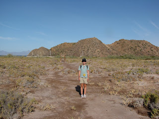
Kelly at the trailhead with the anchorage in the background
The hike begins
Some of the kinds of things we saw on the hike
Kelly and Ryan in the dried up arroyo
Are we there yet?
We made it to the ridge line and could see Salinas on the other side of the island
Kelly and Ryan with the salt pits in the far off distance
The town we hope to visit on the way back was just too far to hike to
The gang on the ridge line overlooking Salinas
Looking back on where we had come from
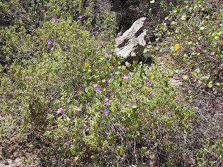
For lawnboy - purple wild flowers blooming on ballandra
Heart-shaped bush we found on the island
The "bee" tree had hundreds of bees in it
The little paper lanterns that Phil really liked
The paper lanterns up close
Ryan climbing the rocks on the way back
Yeah, we made it back!
Carmen, as part of the Loreto national park system has some great hiking up the arroyo on the eastern edge of the bay. You can hike from the anchorage all the way to the other side of the island to the abandoned salt-making town of Las Salinas, but it will take you all day to get there and back. It took us two hours to hike up the arroyo to the ridge line where we could finally see the town, but it would have been at least another hour to get down there. Add a couple of hours to explore the ghost town, plus the return trip, and let's just say our smaller crew members would not have been very happy. Nor would the larger crew members that would have had to carry the smaller ones back. (We actually ended up anchoring on the other side of the island on the way back so we could visit the ghost town.) Still, the hiking was fun and was our longest march since we've been in Mexico. There were plenty of cacti, thorn bushes, interesting vegetation and a surprising number of blue, white and yellow wild flowers. (We’ve included some pictures for the benefit of our friend lawnboy who told us we would find nothing green in the Sea of Cortez.) The Phil’s favorite was a bush with seed pods that looked like miniature Chinese paper lanterns. How something so delicate survives in such a harsh environment is beyond me. We saw plenty of signs of goats and rabbits ("Yes, Ryan, those are rabbit pellets again."), walked next to loads of bees in search of fresh water and, in general, had a grand time. I wonder why everyone went to bed early that night?We spent only two nights in Ballandra since we wanted to keep moving north. The next leg will be 25 miles to Puerto Juanico, a spot that several cruisers have told us is their favorite spot in all the Baja. We'll see...
Wish you were here to enjoy this!


No comments:
Post a Comment